2.06 CALIFORNIA:The fire, the valley and the desert
As climate change exacerbates droughts and wildfires across California, the systems that have been put in place to protect the state from climatic shocks are beginning to fail. But that's not all that is happening, in the absence of federal assistance communities are creating their own support networks.
Burn out, White Wolf Road, Bakersfield, (2019)
California is America’s wealthiest and most populous state. Through the transportation of water and the suppression of wildfires, California has transformed its landscape into America's fruit bowl. Yet as climate change exacerbates droughts, wild fires and floods across the region, the systems that have been put in place to protect the state from climatic shocks are beginning to fail, thereby thrusting another side of California's success story into the spotlight, its social vulnerability.
The 2018 Camp Fire was the deadliest and most destructive wildfire in Californian history. Named after Camp Creek Road, its place of origin in the foothills of the Sierra Nevada near Pulga, the fire started at 6.30am on the 8th of November, 2018. Exacerbated by a climate change intensified fuel load, following 10 years of severe drought, the fire spread rapidly through the grassy and forested landscape above Concow where it destroyed properties before becoming an urban firestorm in the densely populated foothill town of Paradise.
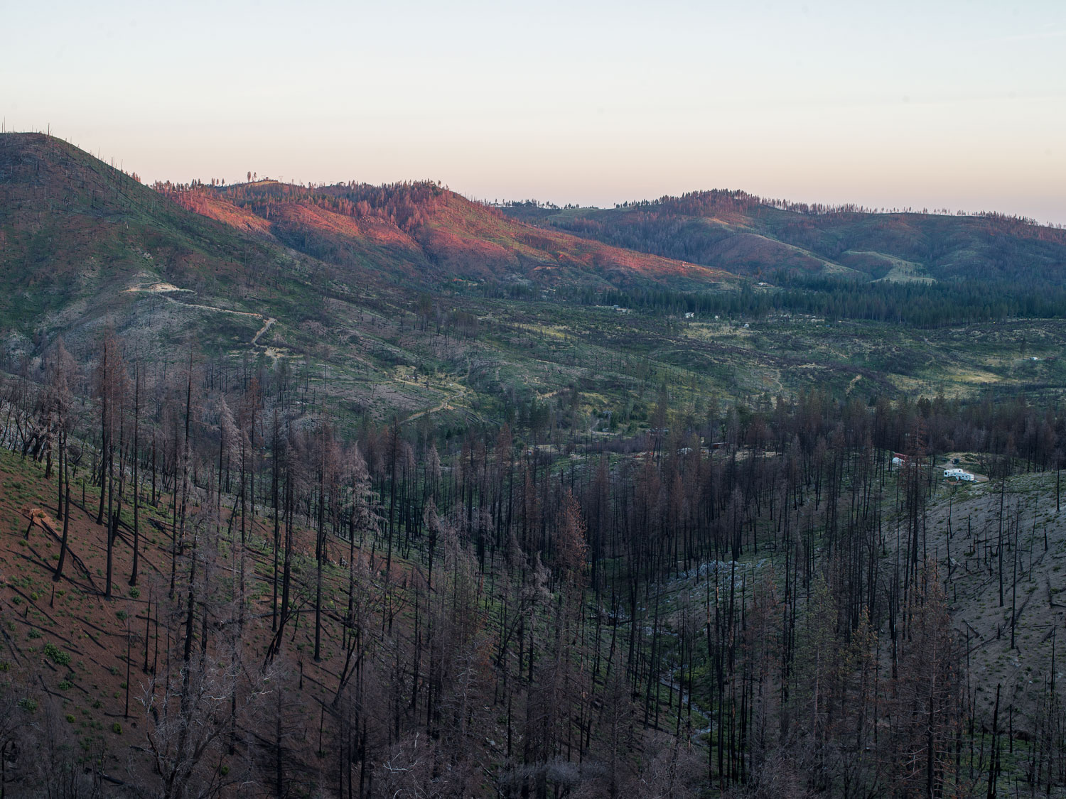
The burnt landscape around Concow Lake, Butte County, California (2019)
The burnt landscape around Concow Lake, Butte County, California (2019)
The fire started when sparks from poorly maintained Pacific Gas & Electric (PG&E) power cables ignited nearby foliage in high winds. On previous Red Flag Days, days that have extreme fire potential, PG&E had cut power to lines that were likely to cause fires but, on this occasion, even though they deployed pre-recorded telephone messages about possible power cuts, the power remained on. PG&E are responsible for starting numerous fires between 2016-2018, including the 2017 Tubbs Fire in Santa Rosa. PG&E has since declared bankruptcy following a lawsuit brought against the company by a trust representing more than 61,000 wildfire victims from Sonoma County and other Northern California communities. Found guilty of causing multiple fires across California, the state has ordered the company to pay 13.5 Billion Dollars in compensation to fire victims.

PG&E Power Lines above Camp Fire Road, seen from Concow, Butte County, California (2019)
PG&E Power Lines above Camp Fire Road, seen from Concow, Butte County, California (2019)
By the time the fire was contained on November 25th it had caused at least 85 fatalities, burnt an area of 153,336 acres (240 sq. miles), and destroyed 18,804 structures, with damage totalling $16.5 billion.
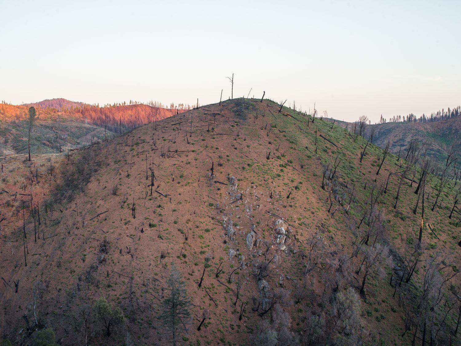
Burnt hill, Concow, Butte County, California (2019)
As a result of the fire consuming buildings and vehicles and fire fighters trying to suppress the blaze, environmental contaminants such as asbestos, benzine, heavy metals, arsenic, dioxins, and other hazardous materials such as fire retardants now pollute the burnt communities and their drinking water infrastructure. Delayed by the decontamination process and deterred from coming back to Paradise by the lack of functional infrastructure, most of the town’s 20,000 former residents have not returned. However as federal support for fire victims dries up many of those that have no financial means to relocate have returned to Paradise to live in RVs, tents or cars and as a result are being exposed to contaminates on their lots.
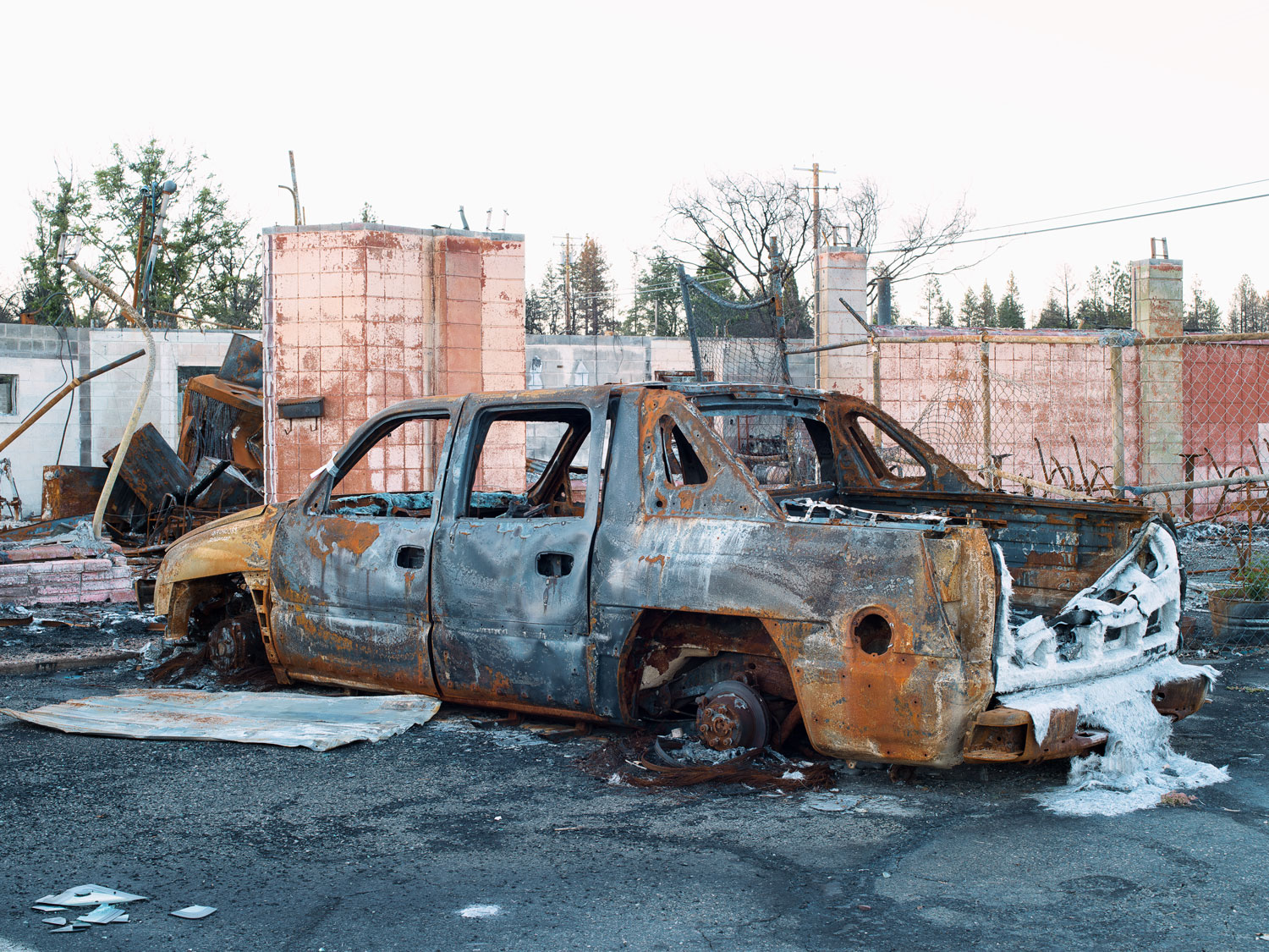
Burnt truck, The White Water Saloon, Paradise, Butte County (2019)

Sam’s Liquor, Paradise, Butte County (2019)
When at 7.46am the first evacuation order was given to residents of the eastern side of Paradise and an automated phone call went out, many were just waking up, on their way to work or dropping of their kids at school and therefore did not receive the order to leave. While others thought that they had more time to evacuate and that the fire would not spread so fast. When at 9.17am it became painfully clear that the evacuation of the whole town was necessary, Paradise was already ablaze with multiple spot fires and by 12.02pm the smoke over paradise was so thick that it plunged the town into darkness.
The Camp Fire, 10.45am, November 8, 2018, Nasa Earth Observatory, (2018)
Derrick left early for college as normal on the morning of the 8th of November, not knowing that the fire that was burning outside of Paradise was going to engulf the town. While waiting for the bus to college, he took this image of the orange glow inferno below the fires smoke plume.

Derrick’s picture of the Camp fire, Magalia Community Church Resource & Recovery Center, Butte County (2019)
Derrick’s picture of the Camp fire, Magalia Community Church Resource & Recovery Center, Butte County (2019)
Derrick and his father lost their home to the fire that day. When they were finally allowed to return to see what remained of their house on the fifth of December, almost a month later, the only belongings that they could salvage were those stored in a floor safe within the concrete foundations of the house and even they were scorched by the intense heat of the inferno. Derrick and his father are currently living in an RV within the parking lot of the Magalia Community Church Resource & Recovery Centre where they both are volunteers.
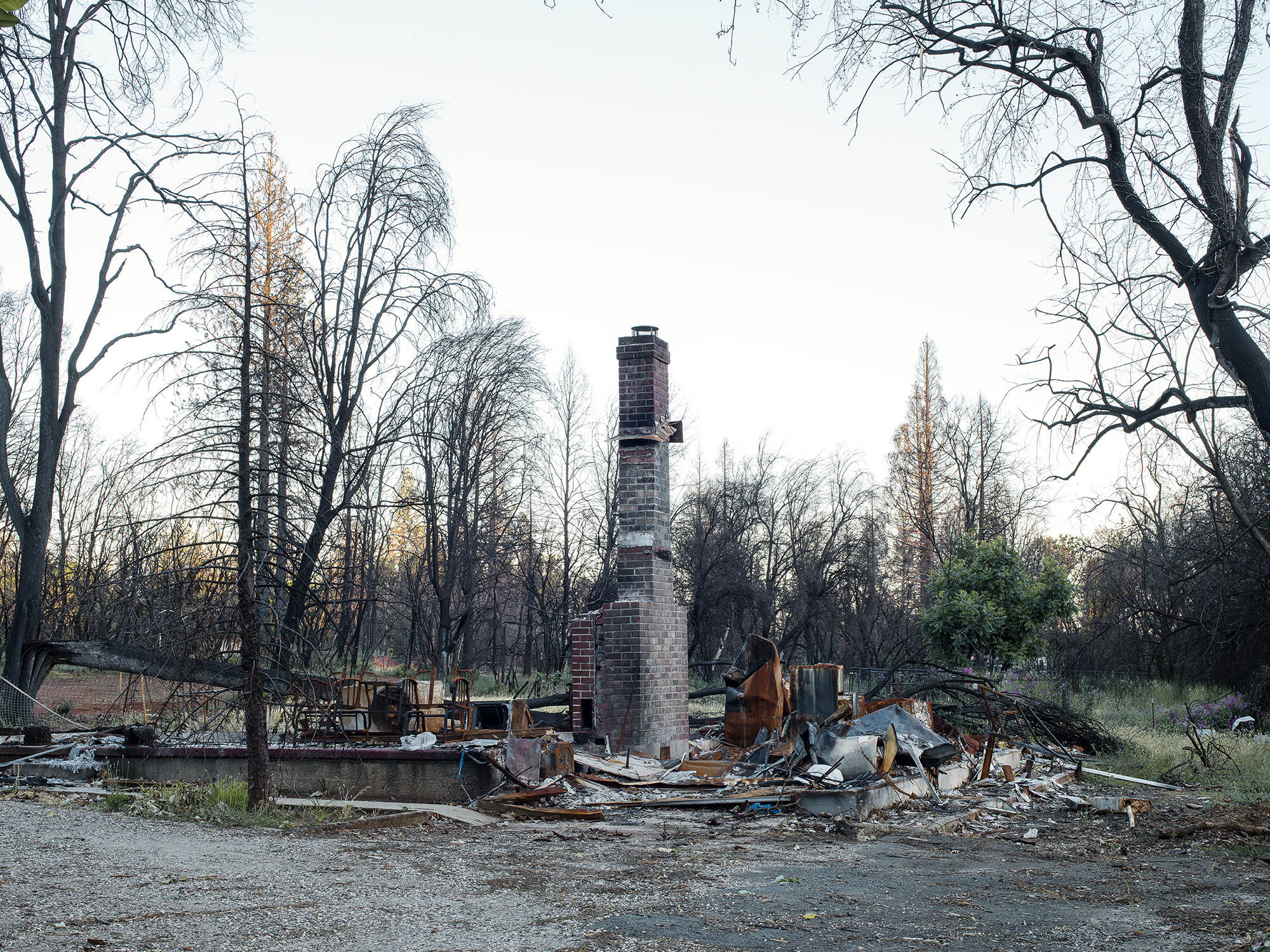
Burnt home, 7194 Clark Road, Paradise, Butte County (2019)
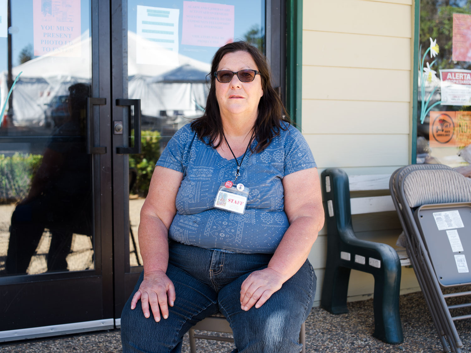
Initially established as a Red Cross distribution centre to dispense food and water when the town first reopened in December 2018, The Magalia Community Church Resource & Recovery Centre unwittingly found itself at the forefront of community efforts to shelter, feed and shower those that had returned to Paradise after the fire.

Reception, Magalia Community Church Resource & Recovery Center, Butte County (2019)
Manned by volunteers, many of whom lost their homes to the fire and some of which now live on site, the centre provides washing facilities, food, household items, toiletries and clothes to members of the community that have been impacted by the fire. The centre, which soon after the fire found itself serving 1000 Camp Fire Survivors a day and still sees 300 beneficiaries on a typical day, is organised and run by Pastor Kevin, known locally as "The Pastor With A Ponytail" and his wife, Shell, Doreen and Dennis, with help from Charlene, Derrick and his father, Cathy and many others.
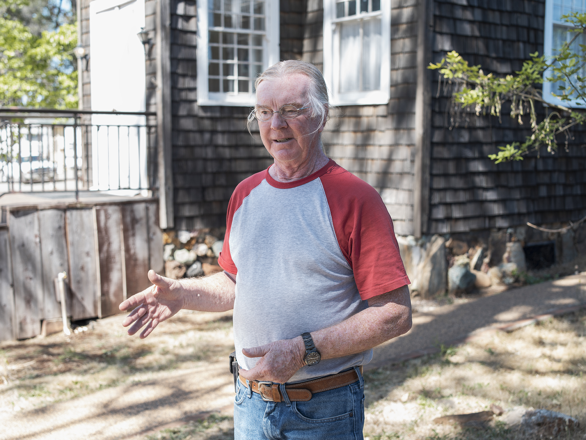
Pastor Kevin, Magalia Community Church Resource & Recovery Center, Butte County (2019)

Vegetable Donations, Magalia Community Church Resource & Recovery Center, Butte County (2019)
Doreen, Magalia Community Church Resource & Recovery Center, Butte County (2019)
Having lost his home in the fire, Dennis began volunteering at the centre and in exchange was given a place to stay. He soon became an invaluable member of the organisational team that runs the distribution of donations to Camp Fire Survivors. He is now living permanently on site in an RV, the brown Winnebago pictured behind him, that was given to him in light of his work for the centre.

Dennis, Magalia Community Church Resource & Recovery Center, Butte County (2019)
Though many of the centres volunteers that have lost their homes continue to live on site, some have returned to live on their lots in tents, cars or RVs following the removal of their destroyed houses and the decontamination process. However, while many lots have been decontaminated, most notably those belonging to affluent returning residents that have already begun to rebuild their homes having paid private contractors to clean up, many of those who are less fortunate are still waiting for lots to be cleaned up by federal agencies. As a result, those who have no other option but to return to Paradise and live on their lots in temporary accommodation are turning to the Magalia Community Church Resource & Recovery Centre for support many months after the fire.

Burnt and melted post and newspaper boxes, 1909-1911 Crandall Way, Paradise, Butte County (2019)
Seven months on from the fire, the Centre still feeds up to 120 families a week through its donations. Beneficiaries, which the centres volunteers refer to as shoppers, are invited to shop for what they need as if they were visiting a supermarket, having been given a shopping basket upon entry. Set up using the shelfs from one of Paradise's supermarkets that closed following the fire, the centre’s food section is arranged into isles. Although food availability varies depending on donations, leading to restrictions on key items like meat, shoppers typically leave with canned fruits and vegetables, pasta, cereal bars, bread, bottled water, juice and when possible, fresh vegetables, meat and dairy products.
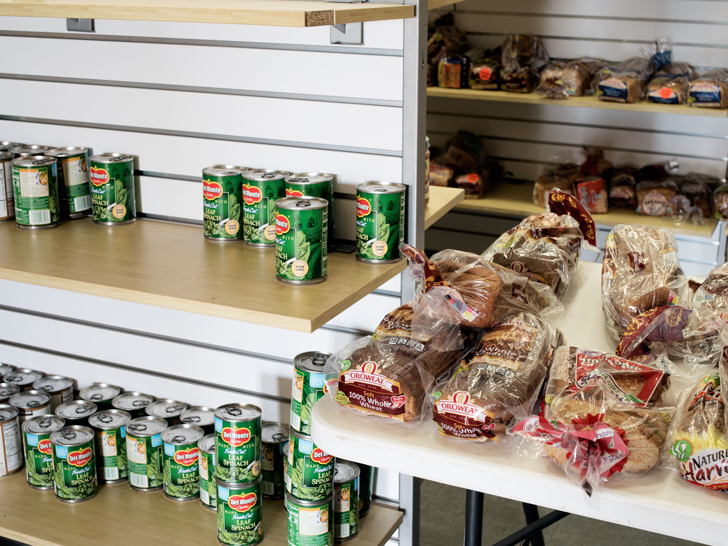
Bread donations, Magalia Community Church Resource & Recovery Center, Butte County (2019)
With food being distributed in the church hall, other provisions such as clothes, cleaning products and household items are given away in large temporary tents that have been set up in the car park of the church.

Camp fire survivors shopping at Magalia Community Church Resource & Recovery Center, Butte County (2019)

Clothing donations, Magalia Community Church Resource & Recovery Center, Butte County (2019)
Not only catering for Camp Fire Survivors, the centre also serves members of the community who were fortunate enough not to lose their homes, who have since been impacted by reduced access to food and water due to the loss of many of the towns shops and businesses during the fire. Miraculously, Bob and Georgia’s home in Magalia was spared by the fire, though many neighbouring properties were totally destroyed. Like most of the former residents of Paradise and Magalia, Bob and Georgia had come to Paradise to retire, in their case from Alaska, and now face the prospect of having to move away if the towns amenities, including medical facilities were not going to be rebuilt.

Bob and Georgia, Magalia Community Church Resource & Recovery Center, Butte County (2019)
In remembrance of the fire Derrick had recently gotten a tattoo on his left forearm. Pointing out the Japanese style flames that represented the fire, the open pinecone at its centre and the date that the fire started: November 8th. Derrick explained that the pinecone refers to species of pine that have adapted to open their cones and release their seeds after being burnt, such as California’s Monterey pine. In this way Derrick said, the tattoo referred to rebirth and new beginnings and not only to the impact the fire has had on his life. Although Derrick’s father cannot currently afford to send him to college, Derrick still aspires to become a personal trainer or a writer, and hopes to attend classes again next year.

Derrick’s Tattoo commemorating the Camp fire, Magalia Community Church Resource & Recovery Center, Butte County (2019)
Derrick’s Tattoo commemorating the Camp fire, Magalia Community Church Resource & Recovery Center, Butte County (2019)
Although residence and local officials wish to rebuild Paradise, questions still remain about how to mitigate the towns vulnerability to future fires and make evacuations safer. With homes being rebuilt and plenty of woodland still left to burn, concerns are being raised about the roads in and out of town. With only five two-lane roads and one four-lane road leading out of town, and 27 thousand people in residence when the Camp Fire struck, traffic congestion caused at least seven fatalities. As residents tried to evacuate, the fire forced officials to close three of the five routes out of town, which clogged the remaining roads. With Skyway road ground to a halt, and it taking as much as two hours to get to Chico from Paradise, normally a 20 minute journey, some had to abandon their cars as they ran out of fuel or as the fire threatened to overwhelm them, which lead fire crews to have to bulldoze cars of the road to gain access to the fire and those who were trapped.

Coutolenc Road, Paradise, Butte County (2019)
The October 2017 Tubbs Fire, was at the time, the most destructive wild fire in California history. Killing 22 people and burning more than 5,643 structures across an area of 36,810 acres (149 km2) the fire cost $1.2 billion (U.S). Now, less than two years after the fire destroyed their homes, many residents have already rebuilt having been paid out by their insurers.

Homes under reconstruction, I. 1996, Long Leat Court, II. 1727 Kerry Lane, III. 3628, Perk Place, Santa Rosa (2019)
With residents constructing houses on their plots in exactly the same way as before, and some building back bigger, with no additional disaster reduction strategies being implemented, the cost of communities living in wildfire prone zones will continue to rise as increasing firefighting expenditure, insurance claims, lost business revenue and depreciating property values weigh in. As long as developers are allowed to build without regulations in wild-land urban interface areas, and as climate change continues to exacerbate the prevalence of wildfires, the vulnerability of communities like Santa Rosa and Paradise across the U.S will increase, leading to more deaths and billions of dollars of additional costs.


Burnt homes are rebuilt, Coffee Park, Santa rosa, Image © Maxar Technologies, Google Earth, (2018-2019)
Homes under reconstruction, I. 1996, Long Leat Court, Santa Rosa (2019), II. 1727 Kerry Lane, Santa Rosa (2019), III. 3628, Perk Place, Santa Rosa (2019)
Although wildfires are naturally occurring phenomena, that are in many ways welcomed by California's forests, because they clear overgrown forest floors and deadwood. Climate change is intensifying fires to the point that they are destroying the trees that normally benefit from a burn. When the Meadow Fire started in Yosemite National Park in the region of Star king Lake during a lightning storm on July 19th 2014, the intense fire killed a large number of trees that would otherwise not have died.

Burn scar from the 2014 Meadow Fire, Nevada Falls seen from Glacier Point, Yosemite National Park (2019)
Unlike many of the previous fires that had afflicted the park the damage caused by the Meadow fire was severe. The high intensity wildfire burned hot and, in some areas, large fir and lodge pole pines were reduced to charcoal effigies. The California Drought, having killed 102 million trees between 2014 and 2016 throughout the state, had increased the fuel load of the fire and made the forest tinder dry. Even after the fire had been extinguished, the drought continued to slow the recovery of areas that had been burnt. Due to the lack of precipitation the forest floor was still covered in a thick layer of ash in the summer of 2015 and re-growth was scarce.

Burn scar from the 2014 Meadow Fire around Mt Starr seen from Glacier Point, Yosemite National Park (2019)
The California Drought also significantly impacted California’s Central Valley. Exacerbating The valley’s already existing water stress, the drought, which lasted from December 2011 to March 2017, was one of the most intense droughts in California history, with the period between 2011 and 2014 being the driest in the states recorded history.
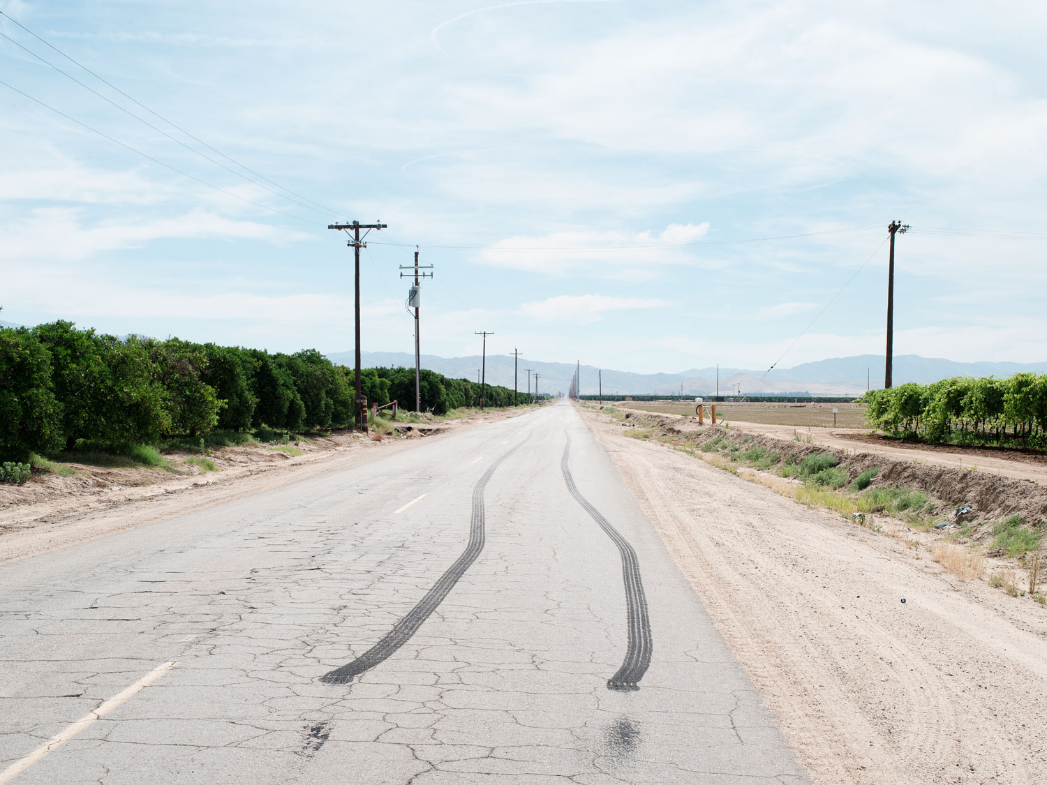
Burn out, White Wolf Road, Bakersfield, (2019)
The valley, which is the most profitable agricultural region in the U.S grows 250 varieties of crops, many of which are water intensive like almonds and oranges. As a result of the drought farmers began to drill additional bore holes and draw hard on the valley's aquifers, further depleting ground water levels and causing the already subsiding valley, which has slumped as much as 10 meters in some areas, to sink deeper.
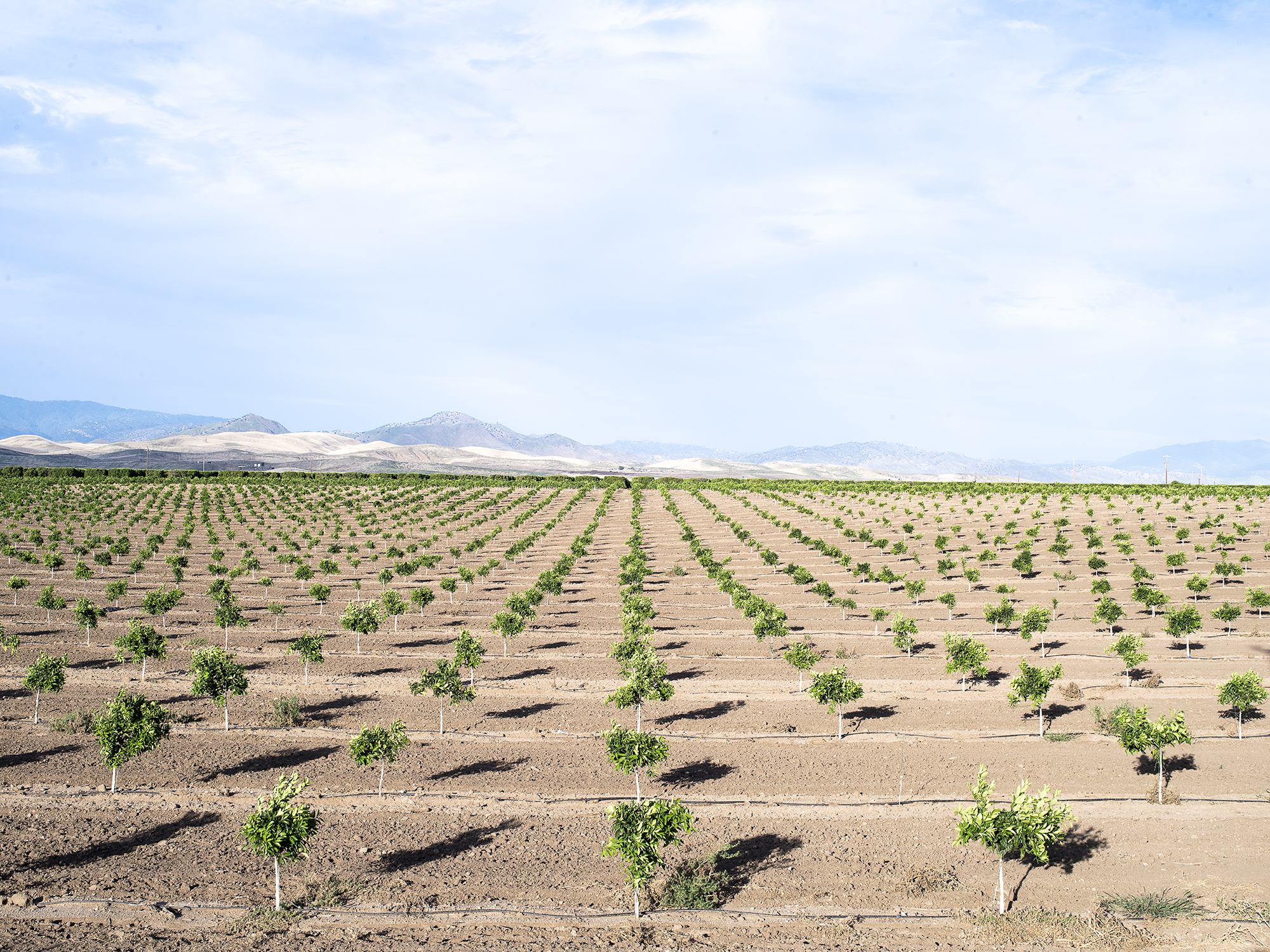
Young orange trees and irrigation, White Wolf Road, Bakersfield, (2019)
As the valleys aquifers are depleted and the land sinks, arsenic is being sucked out of subterranean layers of clay into the ground water. With many of the valley residents depending on groundwater, which they draw from boreholes, for drinking water. Illnesses from longterm exposure to high levels of arsenic, including skin disorders, diabetes, high blood pressure and increased risk of cancer of the liver, bladder, kidney, lungs and skin are becoming increasingly prevalent. With the introduction of The Sustainable Groundwater Management act to curb access to water and shrink the valley’s agricultural footprint by thousands of acres, sizeable portions of the valley will soon be turned into solar-energy farms. With many of the valleys inhabitant’s dependent upon work in the agricultural sector, and their being little alternative employment opportunities if the jobs created by the proposed solar-energy farms are not made accessible to local community members, the prospect of future droughts destroying crops and livelihoods is a daunting one.

Irrigation ditch, Rowlee Road, Wasco, (2019)
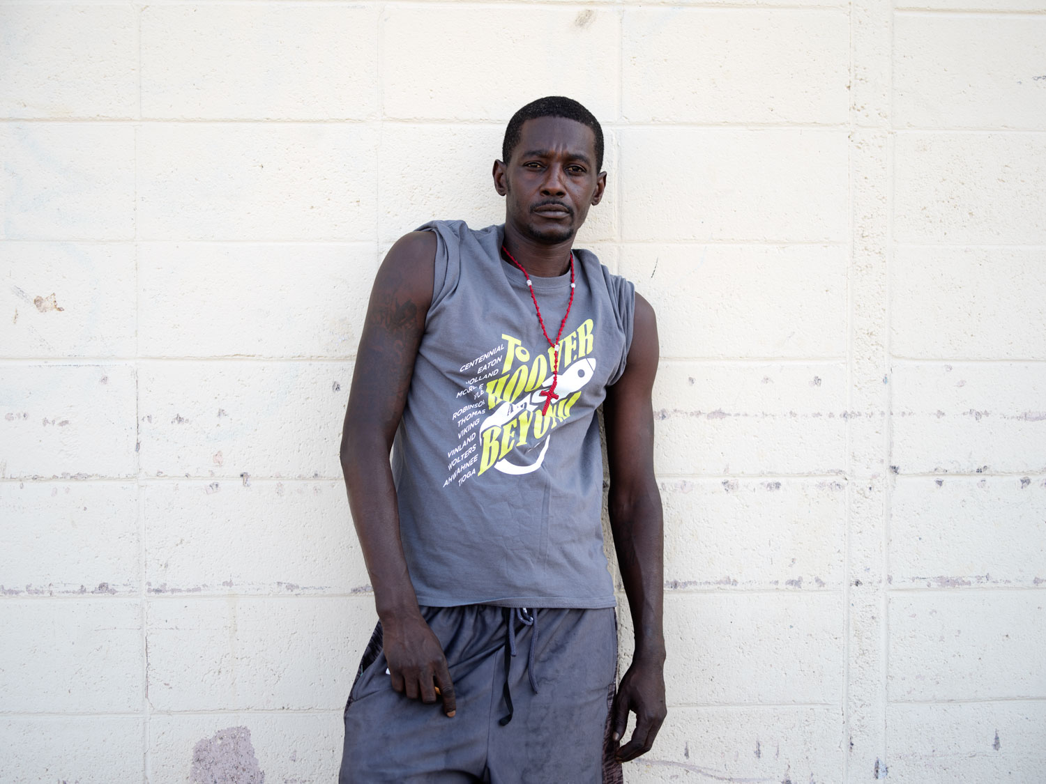
California’s Central Valley suffers from acute poverty of up to 20% in some areas and unemployment rates of up to 9.2%. Six of the ten highest metropolitan unemployment rates in the U.S. are found within the valley’s cities. As a result, the valley has a sizeable homeless population, with approximately 5,000 homeless individuals residing in the city of Fresno alone, where they live in cars, abandoned buildings or on the streets in tents and improvised shelters or out in the open. John, who was from Shasta Country, had in his own words been walking about when he had ended up stuck in Fresno where he was sleeping under a bridge.
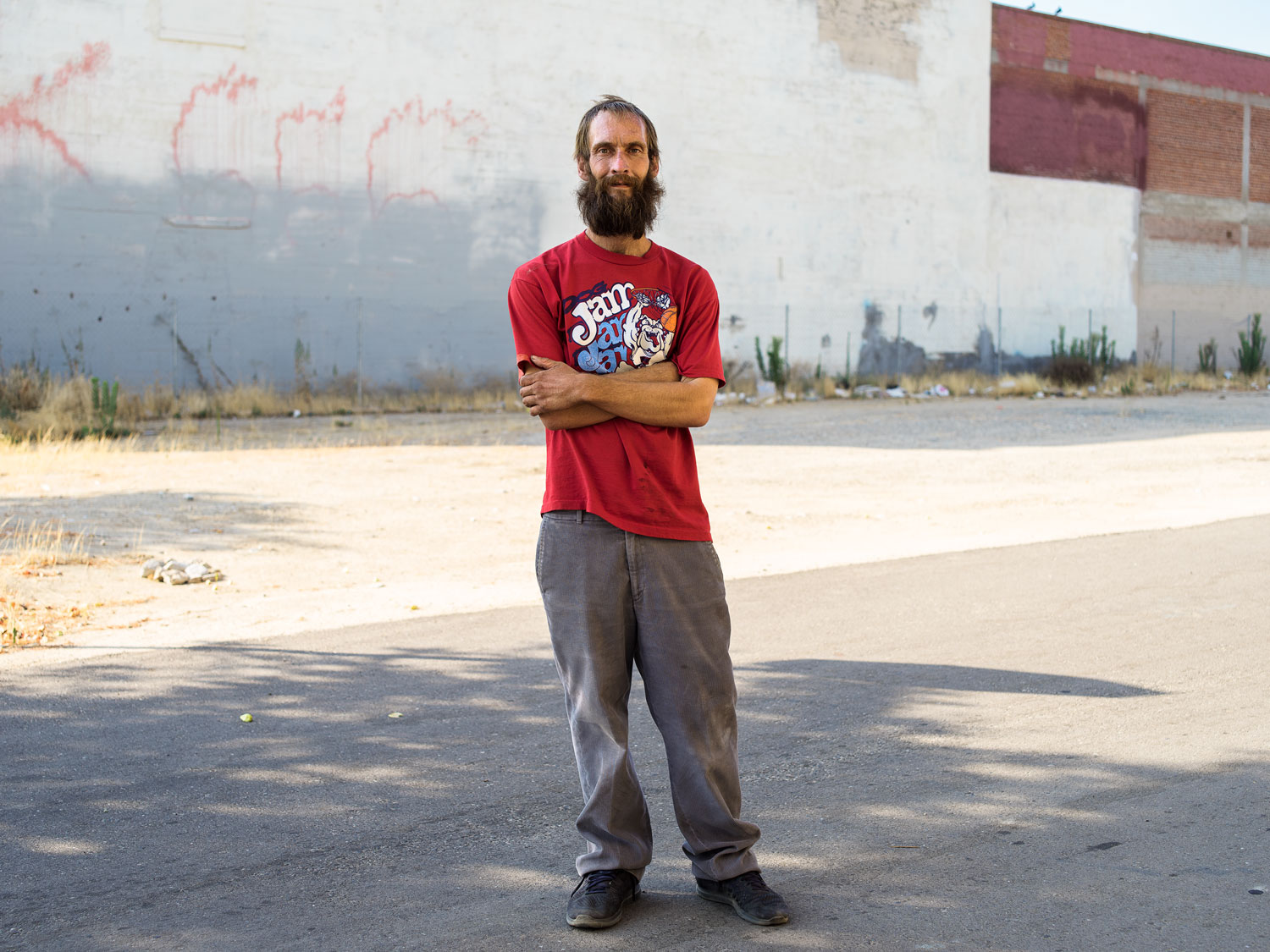
John, H Street, Fresno (2019)
G Street is home to several of Fresno's biggest homeless encampments, which are made up of temporary shelters erected against fences and clusters of tents in close proximity to The Fresno Rescue Mission. The encampments are home to a population of primarily African American and Hispanic residents, most of whom that were from California, like Dan the Lion a retiree originally from Torrance in Los Angeles and one of G Street's best-known residents, who had lived on the street for 5 years. Other residents of G-Street were from as far away as NewYork, such as David who had come to California to avoid the cold. Due to the Fresno’s heavy-handed approach to homelessness, G Street is regularly shaken down in early morning raids by Fresno Police Department's Homelessness Task Force and the cities sanitation department who pressure wash the sidewalks to disinfect them.

Wheelchair, G Street, Fresno (2019)

David from New York, H Street, Fresno (2019)
With little state resources in place to help Fresno's homeless population apart from a monthly social security payment, due to a deficit of temporary housing, community organisations are stepping in to provide support in the form of shelter, access to drug rehabilitation and housing programs, food pantries, soup kitchens and food banks. Staffed primarily by volunteers’, organisations like Poverello house on F street serve more than 1,200 meals a day.
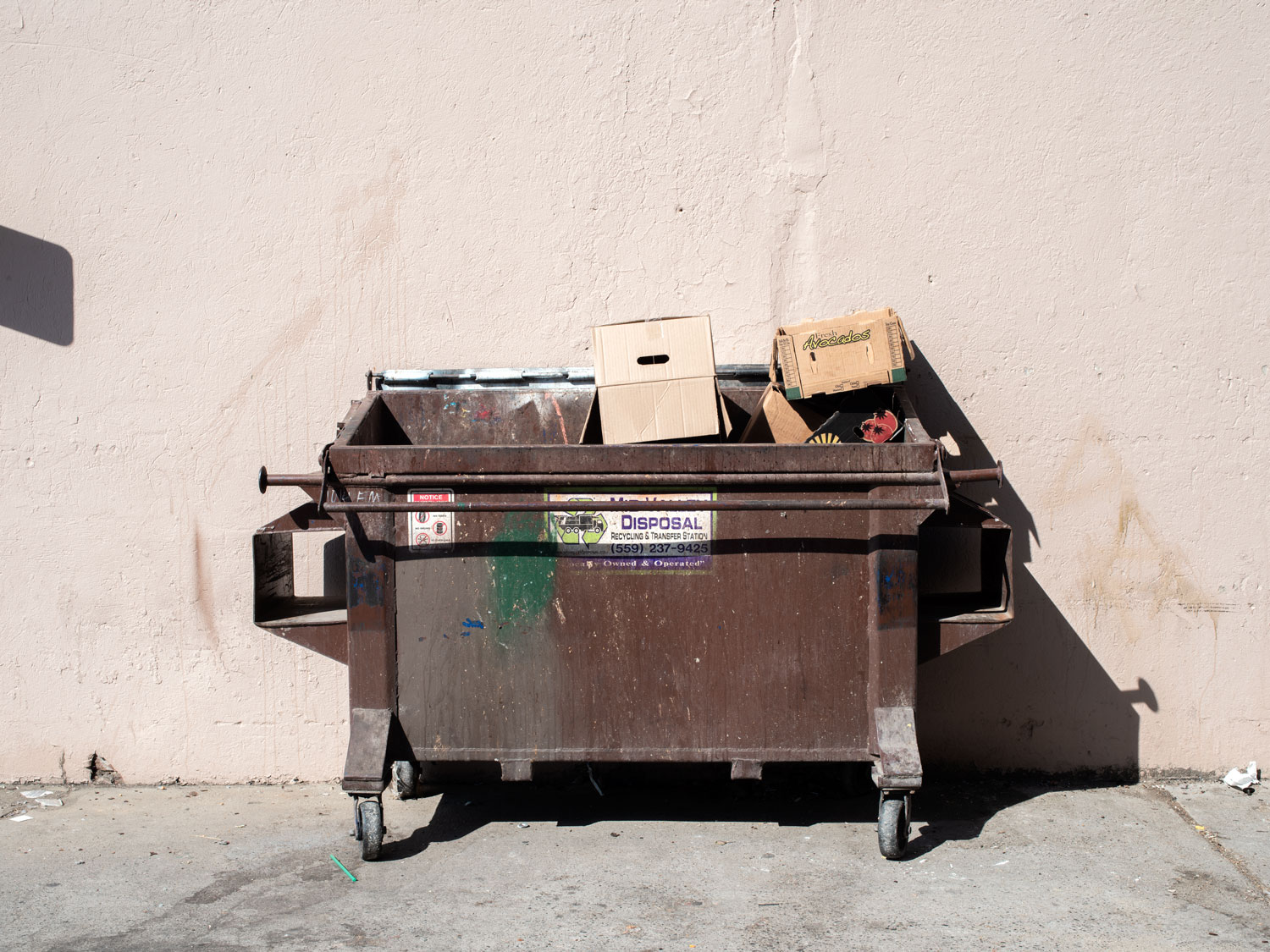
Dumpster, Federal Alley, Fresno (2019)
While some of those who are living on the street in Fresno are there because of meth amphetamine or alcohol addictions, or having chosen the lifestyle, the high price of rent in California, which is due to the lack of affordable housing means that even those who are working full time in low wage jobs are ending up living on the streets. With California already maintaining the nation’s highest number of homeless people and numbers set to increase as wildfires leave increasing amounts of people homeless and properties destroyed, the organisations and those who volunteer to support the homeless will face ever increasing pressure on their resources if the state does not step in to support their operations.
_______ behind the Bank of America, China Alley, Fresno (2019)
Not just dependent upon charity and social security payments, Fresno's homeless community also supports its self. James, a former truck driver who had become homeless following previous problems with alcohol addiction, explained how by working and sheltering together, he and his companions could look after each other. In doing so, the group protected each other and their belongings, pooled resources and money together to buy and cook bulk food products and supported each other’s mental health.

Cart carrying belongings, 4803 East Mckinley Avenue, Fresno (2019)
However, as Maria, a friend of James's explained, a woman’s experience of living on the street was far more dangerous than that of a man. Referring to a well-known homeless individual over on G Street, Maria described how women would only be allowed to stay in the streets encampments by the man if they would have sex with him. For women, Maria said, there is a constant risk of being sexually exploited and forced into prostitution by other homeless men in return for drugs or protection. "That’s why you only hear about homeless women turning up dead in ditches in towns like Fresno and not men" she said.

Maria, Mc Donald’s car park, 4803 East Mckinley Avernew, Fresno (2019)
Fresno was, and still is home to environmental migrants who came to California’s central valley in the 1930’s in search of work when they were displaced from the Mid-West by The Dust Bowl and The Great Depression. Working to pick cotton in the fields surrounding the town, the migrants which were referred to as “Okies” or “Arkies” regardless of where they were from, faced xenophobia, food insecurity and poverty, but ultimately were able to eek out a living where they had not been able to in The Dust Bowl. As water use restrictions reduce the land that can be cultivated in the Central Valley to avoid California's own version of The Dust Bowl, low skilled jobs will decline leaving increasing numbers of people prone to homelessness, unless alternative jobs are generated in sustainable industries or increased support such as a universal basic income, is forthcoming.

Irrigation ditch, Mill Ditch, East Mckinley Avernew, Fresno (2019)
Irrigation ditch, Mill Ditch, East Mckinley Avernew, Fresno (2019)
Although it may lack water, California is not short of sunshine. The Mojave Desert receives as much as twice the amount of solar radiation as other regions of the U.S, at between 6 and 7 kilo-watt hours per square meter per day. This abundance of solar energy is making the desert popular with private developers who wish to build solar power stations as California increasingly strives to ween itself of fossil fuelled energy generation.
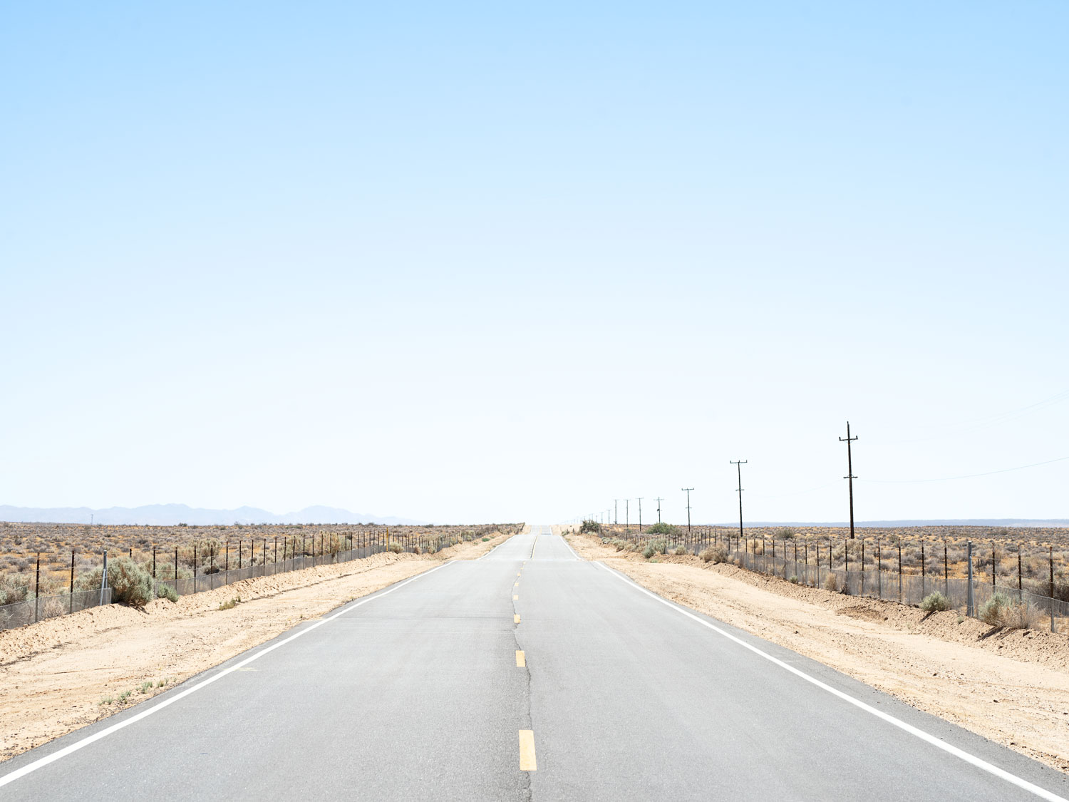
Vanishing point and power poles, Harper Lake Road, Hinkley (2017)
The privately developed Mojave Solar Project generates 617,000 MWh of power annually, enough to power more than 88,000 households and to prevent the emission of over 430 kilotons of CO2. Using the deserts solar thermal energy, the facility generates steam which expands through a turbine generator to produce electricity which is then sold to Pacific Gas & Electric (PG&E). However, the continuing privatisation of renewable energy production in California and the monopolistic character of the electricity industry, could lead to wasteful duplication of infrastructure and generate few incentives to improve and uphold the efficiency and reliability of the power grid as competing firms try to reduce costs, and thereby increase the risk of fires across the state.
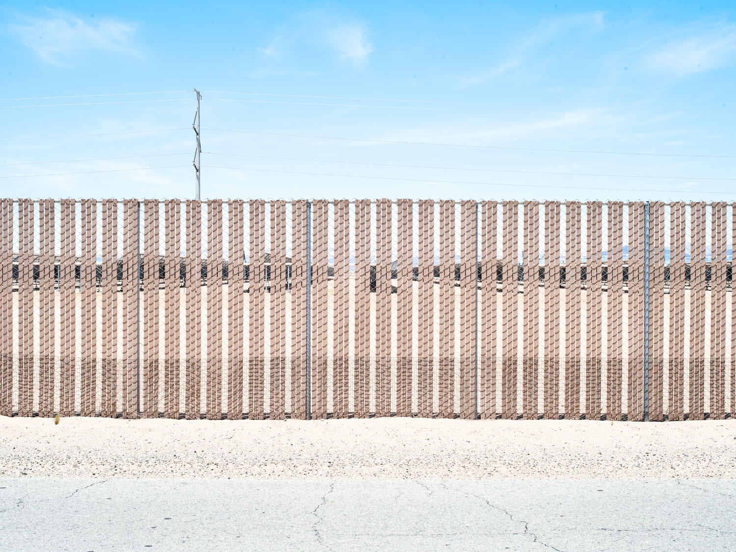
The Mojave Solar Project, Lockhart Ranch Road, Hinkley (2019)

The Mojave Solar Project, Lockhart Ranch Road, Hinkley (2019)
The Mojave Solar Project, Lochart Ranch Road, Hinkley (2019)
Although the Mojave’s solar plants are reducing greenhouse gas emissions they are not without environmental impacts. With most having been built on previously undisturbed desert locations impacts include the destruction of endangered flora, the death of fauna, the use of water for cooling systems in already water stressed areas and, in some cases, the continued emission of greenhouse gasses by solar technologies that utilise fossil fuels.

Wind breaks and power poles, The Mojave Solar Project, Lockhart Ranch Road, Hinkley (2019)
The three towers at the Ivanpah concentrated solar thermal plant are dependent on natural gas to pre-heat their boilers to make steam before commencing operation. In 2014, 46,084 metric tones of CO2 were emitted by the plant to generate 219 GWh of electricity, almost double the GWh that would have been produced by burning the gas alone. Although the efficiency and output of the plant has increased since, it continues to emit carbon dioxide today, while the towers themselves also significantly impact the Mojave deserts wildlife as large numbers of birds and bats are being injured or killed as they are burnt in the 540˚C solar flux created by the mirror field or as they collide with the mirrors themselves.

Ivanpah Solar Power Facility, Heliostat 2, Coloseam Road, Nipton (2019)

Ivanpah Solar Power Facility, Heliostat 1, 2 and 3, from Nipton road, (2019)
With wind power generation providing a less water intensive and ecological impactful alternative to solar, a number of sights within the Mojave Desert have been set aside for wind farms. The Tehachapi Pass, which overlooks the desert, is already home to several different wind farms and was one of the first sites to have been developed to harness wind power in the U.S.. The privately developed Alta wind energy Centre is the third largest on shore wind farm in the world and the largest in the U.S. producing 3.3 million MWh of electricity a year from 600 wind turbines, thereby reducing the states carbon emissions by 5.2 million metric tons of CO2.

Wind turbine in the Alta Wind Energy Centre, Old Creek Road, Mojave (2019)
Without reducing global consumption of electricity and re-purposing former fossil fuel extraction sites to build more efficient nationalised solar and wind facilities, we will continue to destroy valuable ecosystems and risk increasing energy poverty amongst those who will be hardest hit by climate change.
2.06 CALIFORNIA:The fire, the valley
and the desert
As climate change exacerbates droughts, wildfires and floods across California, the systems that have been put in place to protect the state from climatic shocks are beginning to fail. But that's not all that is happening, in the absence of federal assistance communities are creating their own support networks.